
 In Copyright Since September 11,
2000
This web site is
in no manner
affiliated with any Kaiser entity and the for profit Permanente
Link
for Translation of the Kaiser Papers
PATHFINDER(search)
| ABOUT US |
CONTACT
| WHY
THE KAISERPAPERS
|
In Copyright Since September 11,
2000
This web site is
in no manner
affiliated with any Kaiser entity and the for profit Permanente
Link
for Translation of the Kaiser Papers
PATHFINDER(search)
| ABOUT US |
CONTACT
| WHY
THE KAISERPAPERS
|
kaiserpapers.com/downey
HISTORICAL AERIAL PHOTOGRAPHS SHOWING THE LOCATION OF THE CHROMIUM SOIL PLACEMENT, IT'S RELATIONSHIP TO THE REST OF THE PROPERTY AND HOW IT IMPACTED THE EMPLOYEES WHO WERE WORKING IN THE VICINITY. This historical photo shows the end of the helioport outside of Bldg. 1 Here is a closeup of the end of the helioport pad in 2003.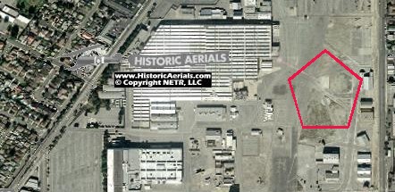
 This is a historical photograph,
dated March 29, 2004 showing again the end of the helio pad
and
the now present Chromiums and Chromium contaminated soil.
This is
the green material that was taken out of building number 1for
the
building of the studio lake which is larger than a football field and
reported to be up to 20 ft deep in some areas.
This is also the material that was reported to glow green in
the
evening. The exact location of this excavation is also
reported
in the Foster
Wheeler Report as the exact location where hundreds of
gallons of Chromiums were poured onto the ground. Also see:
https://kaiserpapers.com/downey/map.html
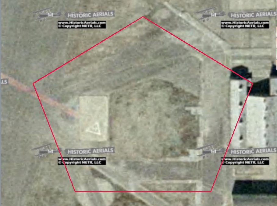
This
is a closeup of the dated March 29, 2004 aerial photograph showing the
Chromium dirt. In this photo most of the toxic dirt is
covered
with plastic and water is leaking out from underneath. See
weather report from that date at: https://kaiserpapers.com/downey/weather.html
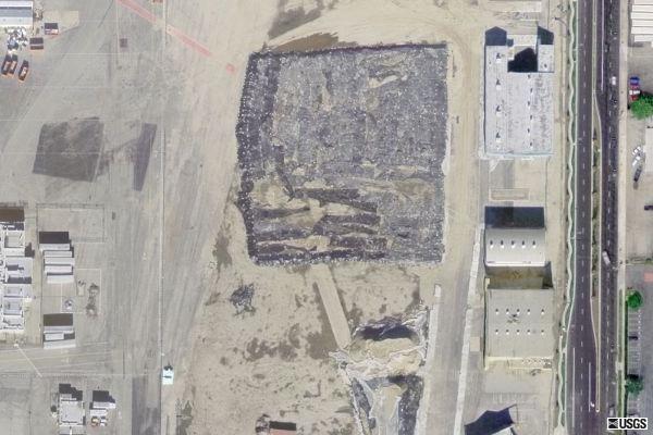
This is a historical photograph,
dated March 29, 2004 showing again the end of the helio pad
and
the now present Chromiums and Chromium contaminated soil.
This is
the green material that was taken out of building number 1for
the
building of the studio lake which is larger than a football field and
reported to be up to 20 ft deep in some areas.
This is also the material that was reported to glow green in
the
evening. The exact location of this excavation is also
reported
in the Foster
Wheeler Report as the exact location where hundreds of
gallons of Chromiums were poured onto the ground. Also see:
https://kaiserpapers.com/downey/map.html
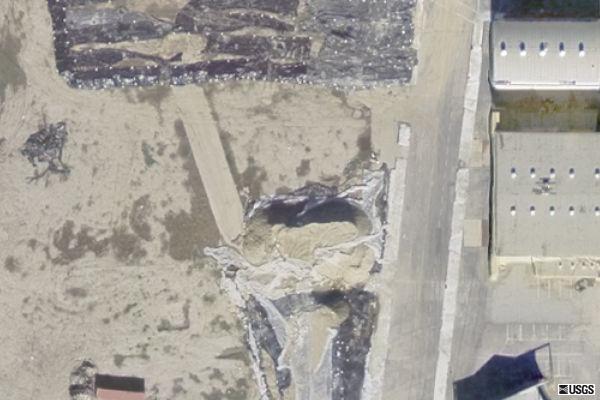
This
is a closeup of the dated March 29, 2004 aerial photograph showing the
Chromium dirt. In this photo most of the toxic dirt is
covered
with plastic and water is leaking out from underneath. See
weather report from that date at: https://kaiserpapers.com/downey/weather.html
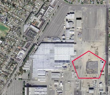
 This
historical aerial photograph dated March 29, 2004 shows the placement
of the Chromium materials at the end of the helio pad.
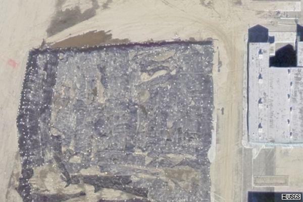
This is a close up of the March
29, 2004 photograph, showing that the Chromium was not covered well.
Statements
from Studio employees that were there in that time period are that they
are the ones upon orders from their bosses that actually covered up the
blowing chromium because it would blow back into the movie studio.
This
historical aerial photograph dated March 29, 2004 shows the placement
of the Chromium materials at the end of the helio pad.
This is a close up of the March
29, 2004 photograph, showing that the Chromium was not covered well.
Statements
from Studio employees that were there in that time period are that they
are the ones upon orders from their bosses that actually covered up the
blowing chromium because it would blow back into the movie studio.
 This
close up from 2005 shows the Suburban Street Movie set with in the
pentagon outline and the arrow in indicating the end of the helio pad
where the chromium dirt contaminated the area.
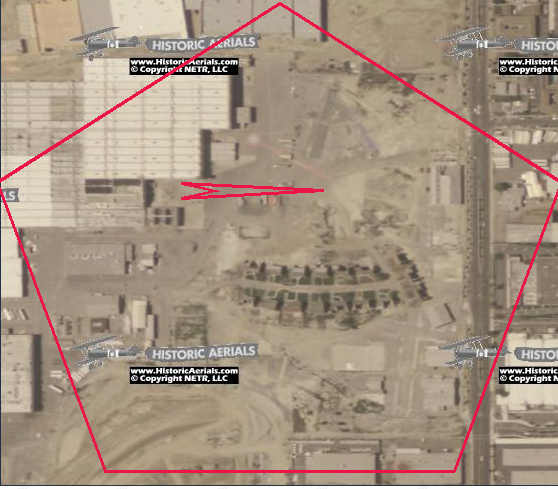
This
close up from 2005 shows the Suburban Street Movie set with in the
pentagon outline and the arrow in indicating the end of the helio pad
where the chromium dirt contaminated the area.
 kaiserpapers.com